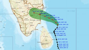
Cyclone Fengal is set to intensify and make landfall near Puducherry between Karaikal and Mahabalipuram by the afternoon of November 30, according to the India Meteorological Department (IMD). The storm is expected to bring heavy to widespread rainfall across Tamil Nadu over the next 2-3 days, with wind speeds reaching up to 90 kmph. IMD has issued alerts for coastal districts, advising precautionary measures as the cyclone approaches. Moderate to heavy rainfall is forecast for most parts of Tamil Nadu, with the heaviest impact near the coastal areas. Real-time updates and the Cyclone Fengal live tracker are available on platforms like Windy to help residents stay informed. Cyclone Fengal Update Today: Deep Depression Unlikely To Intensify Into Cyclonic Storm, Says IMD; Orange Alert Issued for Chennai.
Cyclone Fengal to Make Landfall Near Puducherry on November 30
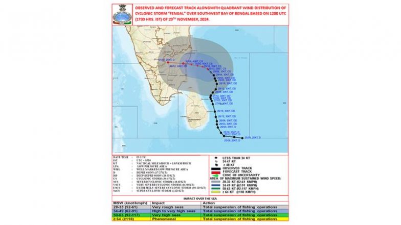
The Cyclonic Storm “FENGAL” [pronounced as FEINJAL] over Southwest Bay of Bengal moved northwestwards with a speed of 15 kmph during past 6 hours and lay centred at 1730 hours IST of today, the 29th November 2024 over the same region near latitude 11.5°N and longitude 81.9°E,… pic.twitter.com/La3VSSE6Uw
— India Meteorological Department (@Indiametdept) November 29, 2024
Cyclone Fengal Live Tracker Map on Windy
(SocialLY brings you all the latest breaking news, viral trends and information from social media world, including Twitter, Instagram and Youtube. The above post is embeded directly from the user's social media account and LatestLY Staff may not have modified or edited the content body. The views and facts appearing in the social media post do not reflect the opinions of LatestLY, also LatestLY does not assume any responsibility or liability for the same.)


 Quickly


