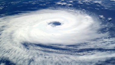
New Delhi, May 24: India Meteorological Department on Friday said that a severe cyclonic storm is very likely to hit the West Bengal and Bangladesh coasts between Sagar Island and Khepupara around Sunday (26th May) midnight. IMD attributed the cyclonic storm to a depression formed over central Bay of Bengal which is continuing to move northward.
“The well-marked low-pressure area over west-central and adjoining south Bay of Bengal concentrated into a depression on the 24th May, over the central Bay of Bengal about 800 km south-southwest of Khepupara (Bangladesh) and 810 km south of Canning (West Bengal). Cyclone Remal Live Tracker Map on Windy: Severe Cyclonic Storm Likely to Hit West Bengal Coast by May 26, Check Real-Time Status.
Cyclone Remal Live Tracker:
Continuing to move nearly northward, it is very likely to cross Bangladesh and adjoining West Bengal coasts between Sagar Island and Khepupara around 26th May midnight as a severe cyclonic storm, it added. IMD has predicted light to moderate rainfall at most places with heavy to very heavy rainfall at isolated places over coastal districts of West Bengal and adjoining districts of North Odisha on 26th & 27th May and isolated extremely heavy rainfall likely over coastal districts of West Bengal on 26th May.
Cyclone Remal
IMD has also forecast light to moderate rainfall at most places with heavy to very heavy rainfall at isolated places likely over Mizoram, Tripura and South Manipur on the 26th and over Assam and Meghalaya, Arunachal Pradesh, Nagaland, Mizoram, Manipur and Tripura on 27th and 28th May. Light to moderate rainfall at most places with heavy to very heavy rainfall at isolated places likely over the Andaman Islands on 24th May. Cyclone Remal Update: Severe Cyclone Forming in Bay of Bengal To Make Landfall Between Sagar Island in West Bengal and Khepupara in Bangladesh on May 26, Says IMD.
According to IMD, wind speed reaching 40-50 kmph gusting to 60 kmph is likely to prevail over the central and adjoining South Bay of Bengal on 24th May. Wind speed reaching 40-50 kmph gusting to 60 kmph is likely along and off Bangladesh, West Bengal and adjoining North Odisha coasts from 25th May evening which is likely to increase becoming gale wind speed reaching 60-70 kmph gusting to 80 kmph from the morning of 26th May and 100-120 kmph
Rough to very rough sea conditions are likely over the central and adjoining south Bay of Bengal on 24th May. Fishermen are advised not to venture into the south Bay of Bengal and the Andaman Sea till 24th May, the central Bay of Bengal till 26th May and the North Bay of Bengal from 25th May to 27th May. Fishermen out at sea have also been advised to return to the coast.
(The above story first appeared on LatestLY on May 24, 2024 03:12 PM IST. For more news and updates on politics, world, sports, entertainment and lifestyle, log on to our website latestly.com).


 Quickly


