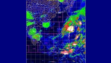
New Delhi, March 22: The deep depression over north Andaman Sea, which did not intensify into a cyclonic storm as predicted, continued to progress northwards and is likely to cross Myanmar coast sometime on Tuesday afternoon itself.
"The Deep Depression moved nearly northwards with a speed of 20 kmph in the wee hours, and lay centered at 8:30 a.m. about 290 km north-northeast of Mayabundar (Andaman Islands), 420 km north-northeast of Port Blair (Andaman Islands) and 270 km southwest of Yangon (Myanmar)," India Meteorological Department (IMD) bulletin said.
"It would continue to move nearly northwards away from Andaman Islands and cross Myanmar coast as a Deep Depression around afternoon," it further added. Cyclone Asani Live Tracker Map on Windy: Cyclone Asani Triggers Rains in Andaman; Check Real-Time Status And Landfall Update.
Till late Monday evening, the IMD had maintained that the deep depression was likely to intensify into a cyclonic storm on Tuesday evening and continue to move nearly northwards along, off the Andaman Islands towards Myanmar and cross Myanmar coast during the early hours of Wednesday.
Now as the meteorological analysis of the situation continues, the IMD is yet to declare the exact reason for the change. As the depression has moved away from Andaman and Nicobar Islands, only light to moderate rainfall has been predicted at few places at Andaman on Tuesday.
With squally winds speed reaching 55-65 kmph gusting to 75 kmph prevailing over north Andaman Sea and adjoining east central Bay of Bengal, off the Myanmar coast and north Andaman Islands, sea condition is very likely to be rough.
The fishermen are still advised not to venture into the Andaman Sea, along and off the Andaman Islands and along and off the Myanmar coast during the day on Tuesday.
(The above story first appeared on LatestLY on Mar 22, 2022 01:14 PM IST. For more news and updates on politics, world, sports, entertainment and lifestyle, log on to our website latestly.com).


 Quickly


