")
")


 Quickly
")


")

")


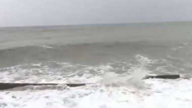
New Delhi, May 1: The Indian Meteorological Department (IMD) warned of low pressure formation over parts of Arabian Sea and Bay of Bengal in the next 24-48 hours. The sea disturbances may culminate into the first cyclonic storm of the season. In case the storm erupts, it will be referred to "Amphan", said M Mohapatra, director general of IMD. Arnab, Aag, Tej, Vyom, Gati: IMD Releases Names of Upcoming 169 Cyclones in 13 Countries in Indian Ocean & Arabian Sea.
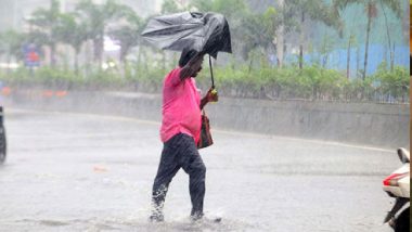
The cyclonic activity would be accompanied with western disturbances which would lead to rainfall in the North Indian states, predict the Met Department. The rains could be scattered across Punjab, Haryana, Chandigarh, Delhi, Uttar Pradesh and Rajasthan from May 3-6, the officials claimed.
The rainfall predicted in the above states, along with the entire belt of Western Himalaya, is expected to be accompanied with thunderstorm, hailstorms and gusty winds of upto 30-40 kmph.
The weather body has also warned those in the coastal states to not to venture along the sea from today onwards. The fishermen were also asked to abandon their activities till the phase of likely low pressure formation in sea is over.
See PBNS Tweet
Low Pressure area over south Andaman Sea & adjoining southeast Bay of Bengal: Cyclone Warning Division
Fishermen are advised not to venture into southeast Bay of Bengal on 1st May, into South Andaman Sea & Southeast Bay of Bengal on 2nd & 3rd May.
— Prasar Bharati News Services (@PBNS_India) May 1, 2020
"Low pressure area over south Andaman Sea and adjoining southeast Bay of Bengal, as per the Cyclone Warning Division. Fishermen are advised not to venture into southeast Bay of Bengal on 1st May, into South Andaman Sea and Southeast Bay of Bengal on 2nd and 3rd May," said a statement issued by the Prasar Bharti News Service.
(The above story first appeared on LatestLY on May 01, 2020 03:26 PM IST. For more news and updates on politics, world, sports, entertainment and lifestyle, log on to our website latestly.com).