New Delhi, October 30: Nearly 36 million people in India will be threatened by flooding annually by 2050 if green house gas emissions are not reduced, a new study has said, showing the potential of climate change to reshape cities, economies and coastlines within our lifetimes. By 2100, it warned, 44 million people will be under the risk of annual flooding due to rise in the sea level. The study by US-based NGO Climate Central said six Asian countries - India, China, Vietnam, Bangladesh, Indonesia and Thailand - where 237 million people live, could face annual coastal flooding threats by 2050, roughly 183 million more than assessments based on prevailing elevation data.
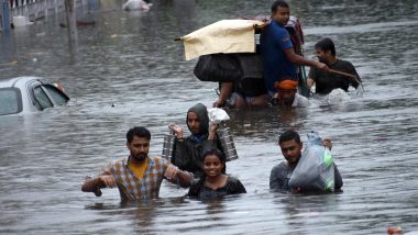
The findings are based on Coastal DEM, a new digital elevation model developed by Climate Central, the NGO said in a statement. "Six Asian countries are home to the great majority of people - approximately 237 million combined - living in places that without coastal defence could experience coastal flooding at least annually by 2050, more than quadrupling estimates based on older elevation data," it said. "Asian countries see biggest increases in threatened land." Bihar Floods: 73 Dead, Patna Continues to Reel Under Impact of Flood; NDRF Evacuates Over 9,000 People From Affected Areas.
The study said by 2100, two more countries - Japan and Philippines - will experience annual tidal flooding with 22 million people at risk. Scott Kulp, a senior scientist at Climate Central and lead author of the study, said, these assessments show the potential of climate change to reshape cities, economies, coastlines, and entire global regions within our lifetimes.
As the tideline rises higher than the ground people call home, nations will increasingly confront questions about whether, how much, and how long coastal defence can protect them, he added. The study added that by the end of this century, assessments based on CoastalDEM suggest that without defence, land now home to as many as 420 million people worldwide could be vulnerable to annual coastal floods, even if moderate cuts to carbon emissions are achieved.
The researchers used machine-learning methods to correct for systematic errors in the principal elevation dataset used until now for international assessment of coastal flood risks, NASA''s Shuttle Radar Topography Mission (SRTM). Coastal DEM-derived estimates of the global population at risk are three times greater than values produced using SRTM elevation data.


 Quickly


