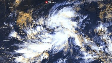
Miami, September 9:Tropical Storm Francine formed on Monday off the coast of Mexico and was expected to drench the Texas coast with up to a foot (30 centimeters) of rain before coming ashore in Louisiana Wednesday night as a hurricane. “We're going to have a very dangerous situation developing by the time we get into Wednesday for portions of the north-central Gulf Coast, primarily along the coast of Louisiana, where we're going to see the potential for life threatening storm surge inundation and hurricane force winds,” said Michael Brennan, director of the US National Hurricane Centre in Miami. Tropical Storm Francine Forms off Mexico, Aiming for the Louisiana Coast.
Francine is taking aim at a stretch of coastline that has yet to fully recover since hurricanes Laura and Delta decimated Lake Charles, Louisiana, four years ago. The hurricane centre said Francine is located about 245 miles (395 kilometers) southeast of the mouth of the Rio Grande, and about 480 miles (770 kilometers) south-southeast of Cameron, Louisiana. Francine's top winds Monday morning were about 50 miles per hour (85 kilometers per hour). A tropical storm is defined by sustained winds between 39 mph and 73 mph (62 kph and 117 kph). Typhoon Yagi Kills 14 in Vietnam as Officials Warn of Heavy Rain That Can Cause Flooding.
Francine should be a hurricane as it approaches the northwestern Gulf Coast on Wednesday, pushing a storm surge of up to 10 feet (3 metres), forecasters said. “Francine is expected to bring heavy rainfall and the risk of considerable flash flooding along the coast of far northeast Mexico, portions of the southernmost Texas coast, the Upper Texas Coast, southern Louisiana, and southern Mississippi into Thursday morning. A risk of flash and urban flooding exists across portions of the Mid-South from Wednesday into Friday morning,” the hurricane centre warned.
(The above story is verified and authored by Press Trust of India (PTI) staff. PTI, India’s premier news agency, employs more than 400 journalists and 500 stringers to cover almost every district and small town in India.. The views appearing in the above post do not reflect the opinions of LatestLY)


 Quickly


